
~ Current Schedule ~
How scheduling works:
 One of the Canes, who will be the "leader" of the outing, decides he or she will hike or paddle or bike or ski and works with our Outings Coordinator to describe the outing, which then is posted on this web page. The posting constitutes an invitation to other Canes to join in the outing, subject to two essential conditions: that by joining in the outing a participant represents he or she is physically fit for the particular outing and accepts all risks inherent in the outing activities including risk of injury. New participants are requested to fill out an Acknowledgement of Risk Agreement and submit it to the outing's leader but accepts all risks whether this Agreement is submitted or not. A leader is not a professional guide but merely the volunteer Cane who has invited other Canes to join in the outing. Adverse weather may result in cancellation or postponement; check the schedule for updates.
Practices and traditions: Our traditions go back 45 years. Advance signup is not required. However, prior to attending your first outing, read the information on our Practices and Acknowledgement of Risk pages. Download and sign the Acknowledgement of Risk Agreement form and submit it to the leader of your first Canes outing. At the end of this Schedule is information that may be useful regarding meeting places, outing types, difficulty and useful links.
Today is ,

Refresh the page in your browser to assure you see the latest content.
Scheduled outings: Canes enjoy a variety of outings. Easy-rated hikes are generally listed as ALT to allow for a more strenuous Regular outing on the same date. Bonus outings on other days are also encouraged. If you would like to volunteer to lead an outing please contact Leo Demers, Outings Coordinator. Moderate hike ideas for warm days? Stay hydrated and catch the westerly breeze on the mountains on the east side of Lake George: Black, Erebus and/or Fishbrook Pond, Sleeping Beauty, Buck from Shelving Rock Rd, Pilot Knob Ridge.
Thursday's Potash Mtn hike has been canceled due to threatening adverse weather and has been rescheduled for Aug 6th.Jul 30, 2026 No outing yet scheduled
Aug 6, 2026 Regular Potash Mtn hike Rating: Moderate Leo Demers 518-654-8042 Email leader WX
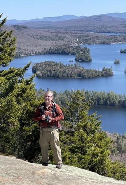
I plan to lead a hike to Potash Mountain in Lake Luzerne. It isn’t a very high mountain at only 1700 feet, but what it lacks in height it makes up in character. It is dome-shaped with south-facing cliffs, an eye-catcher that can be identified from many of the higher mountains in the area, with super views from the expansive open rock ledges above the cliffs. The hike, including a nature trail, is slightly less than 4 miles RT with a 1000-foot elevation gain, steep in places, but the route has received a great deal of trail improvements, with stone steps and stairways in the steepest sections. Lunch will be at the overlook near the summit.
Meet at CTL at 9:30am for departure at 9:45, or at the trailhead at 10:00ish. Trailhead directions: From Exit 21 of the Northway, go south on Rt 9N for about 7 miles. Potash Rd will be on the right. If you are traveling north on Rt 9N, Potash Rd will be 3 miles past Hadley-Luzerne HS, on the left. Trailhead parking is located on the R on Potash Rd 0.5 mile N from the Rt 9N turn and has a sign that reads "Harris Land Preserve Trailhead". If you have any questions please contact me.
Aug 13, 2026 No outing yet scheduled
Aug 18, 2026 Tue Celebration of Karen Burke's Life
Karen was a member of the Crooked Canes for many years. She introduced her Monday hikers to some of her Canes friends, including Peter Fedorick, who led several of her hikes. Karen passed away at Albany Medical Center on May 10th. Following is info from her Monday hiking group about a Celebration of Karen's life.
Please join us in an informal celebration of the life of Karen Burke. Karen led our Monday hikes for more than a decade. She left us a beautiful legacy of lasting memories and lasting friendships. WHEN: Tuesday, August 18, 10 AM - ? WHERE: Northampton Beach Campsite, 328 Houseman Street, Mayfield Bring a dish: hot dogs, hamburgers, sausages, charcuterie, salad, dessert-- to share and your own choice of drink. Wood or charcoal. Bring a place setting. The campsite has a pavillon, picnic tables, and fireplaces. Bring a folding chair. Bring a written memory of Karen for a “memory jar” that we’ll give to Karen’s family. You are welcome to share your memory with us. KINDLY REPLY to Nolan Marciniec by Tuesday, August 4. Email nolanm29@icloud.com or phone/text 518-775-0211.
Aug 20, 2026 No outing yet scheduled
Aug 27, 2026 No outing yet scheduled
Sep 3, 2026 No outing yet scheduled
Sep 10, 2026 Crooked Canes Annual Picnic Save the date!
Details to follow
Meeting place: Carol Thomas Lane "CTL" unless specified otherwise in the outing description. More info on CTL, meeting places and times.
Outing types: Outing types are listed as Regular, Alternate (ALT) or Bonus. More info on outing types.
Difficulty: Outing difficulty ratings are shown as "Easy," "Moderate," "Difficult", or a hybrid. These are subjective ratings, and even an "Easy" outing will require attendees to be fit and aware of their physical limitations. More details about difficulty are typically shown in the outing description. Distance and elevation gain shown are generally derived from GPS readings, which are approximate. More info about ratings.
Lead an outing: If you would like to volunteer to lead an outing, please contact an Outings Coordinator. Here's a more detailed information guide. The earlier you respond, the more time your fellow Canes will have to plan to attend your outing.
Air quality, ticks, hunting season, interactive map, and other info: Wild fires in Canada and the western US can cause hazy skies and may also affect ground-level air quality. Check regional air quality for today and links to other useful info.
Seeking a Co-Coordinator: Leo Demers, our Outings Coordinator, is seeking a Co-Coordinator to share the responsibilities, which involve coordinating outings with leaders. This is an opportunity for a Cane to give something back to the Crooked Canes and assure we continue to thrive. Contact Leo to volunteer and/or ask questions.